webexcess/openstreetmap
Composer 安装命令:
composer require webexcess/openstreetmap
包简介
Easy and flexible OpenStreetMap Implementation as NodeType or Fusion Component
README 文档
README

Easy and flexible OpenStreetMap Implementation as NodeType or Fusion Component.
Installation
composer require webexcess/openstreetmap
Built for Neos
Implemented Styles
| Original | Grayscale | Dark |
|---|---|---|
 |
 |
 |
Default JS & CSS
By default, this plugin loads a JS and CSS file.
It's best practice to include them in your custom builds and remove the default assets:
prototype(Neos.Neos:Page) {
  head.stylesheets.openStreetMap >
  body.javascripts.openStreetMap >
}
Editor Settings
# default |
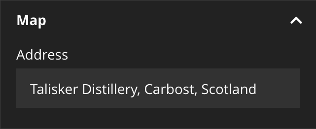 |
'WebExcess.OpenStreetMap:Map': |
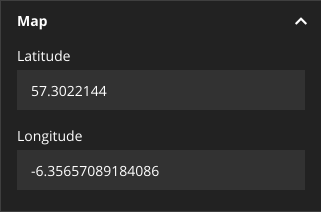 |
'WebExcess.OpenStreetMap:Map': |
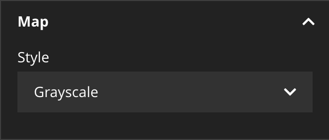 |
'WebExcess.OpenStreetMap:Map': |
 |
Default Settings
WebExcess:
  OpenStreetMap:
    tilesUrl: 'https://{s}.tile.openstreetmap.org/{z}/{x}/{y}.png'
    minZoom: 6
    maxZoom: 18
    style: ~ # ~, grayscale or dark
    ratio: '3:2'
    address: ~ # Talisker Distillery, Carbost, Scotland
    lat: ~ # 57.302387
    lon: ~ # -6.356159
    paddingTopLeft: [100, 100]
    paddingBottomRight: [100, 100]
    mapOptions: []
Fusion only Implementation
Disable NodeType
'WebExcess.OpenStreetMap:Map':
  abstract: true
Simple
map = WebExcess.OpenStreetMap:Map.Component {
  address = 'Talisker Distillery, Carbost, Scotland'
  tooltip = 'Talisker Distillery'
  popup = 'Also have a look at <a href=\\"https:\/\/unsplash.com\/search\/photos\/talisker-bay\\" target=\\"_blank\\">Talisker Bay<\/a>.'
}
Advanced
map = WebExcess.OpenStreetMap:Map.Component {
  lat = 57.302387
  lon = -6.356159
  style = 'dark'
  ratio = '4:1'
  renderer.content.customOverlay = Neos.Fusion:Tag {
      @position = 'after map'
      content = 'A Special Information..'
  }
}
GeoJSON
inline with multiple markers..
map = WebExcess.OpenStreetMap:Map.Component {
json = '[{"type":"Feature","properties":{"tooltip":"Talisker Distillery"},"geometry":{"type":"Point","coordinates":[-6.356159,57.302387]}},{"type":"Feature","properties":{"popup":"Talisker Bay<br \/>» <a href=\\"https:\/\/unsplash.com\/search\/photos\/talisker-bay\\" target=\\"_blank\\">Photos<\/a>"},"geometry":{"type":"Point","coordinates":[-6.456646,57.283313]}}]'
}
or with an external source..
map = WebExcess.OpenStreetMap:Map.Component {
  json = '/talisker-geo.json'
}
EEL Helper
Geocode.latLonFromAddress('Talisker Distillery, Carbost, Scotland')
Interacting with JavaScript
Methods
mapIds = window.openStreetMap.getMapIds();
> Array [ "map-d8aaafcf-b2fa-4240-8a28-ed48b6e6143c", "map-b9ffb901-e91e-4261-a127-ec3246bc6350", .. ]

map = window.openStreetMap.getMap('map-d8aaafcf-b2fa-4240-8a28-ed48b6e6143c');
> { MapObject }

markers = window.openStreetMap.getMarkers('map-d8aaafcf-b2fa-4240-8a28-ed48b6e6143c');
> Array [ { MarkerObject }, { MarkerObject }, ... ]
Events
document.addEventListener('initializedOpenStreetMap', e => {
    console.log(e);
});
> { details: { map: { MapObject }, mapId: 'map-123..' }, ...DefaultEventProperties }

document.addEventListener('addedOpenStreetMapMarkers', e => {
    console.log(e);
});
> { details: { map: { MapObject }, mapId: 'map-123..', geoJson: { GeoJSON } }, ...DefaultEventProperties }
MarkerCluster Example
Load the Leaflet plugin..
<link rel="stylesheet" href="https://unpkg.com/leaflet.markercluster@1.1.0/dist/MarkerCluster.css" />
<link rel="stylesheet" href="https://unpkg.com/leaflet.markercluster@1.1.0/dist/MarkerCluster.Default.css" />
<script type="text/javascript" src="https://unpkg.com/leaflet.markercluster@1.1.0/dist/leaflet.markercluster.js"></script>
Register a JS hook..
prototype(WebExcess.OpenStreetMap:Map.Component) {
  mapHooks.addMarkersLayerHook = 'myAddMarkersLayerHook'
}
Load the plugin with your hook..
window.myAddMarkersLayerHook = (layer) => {
  const clusterMarkers = L.markerClusterGroup()
  return clusterMarkers.addLayer(layer)
}
Leaflet Map Options
See leafletjs.com
Via default settings
WebExcess:
  OpenStreetMap:
    mapOptions:
      scrollWheelZoom: true
Via Fusion
prototype(WebExcess.OpenStreetMap:Map.Component) {
  mapOptions {
    scrollWheelZoom = true
  }
}
Inspector Editor
Feel free to add custom Editors to enhance your Editors experience as he need's it.
Acknowledgements
Thanks to OpenStreetMap for providing free and open map data. And thanks to leafletjs.com for providing an open-source JS library for interactive maps.
developed by webexcess GmbH
webexcess/openstreetmap 适用场景与选型建议
webexcess/openstreetmap 是一款 基于 CSS 开发的 Composer 扩展包,目前已累计 50.39k 次下载、GitHub Stars 达 10, 最近一次更新时间为 2018 年 09 月 10 日, 在 PHP 生态内属于活跃度较高的组件。
我们在过去多个企业项目中使用过 webexcess/openstreetmap 或与其功能相近的方案,如果你在选型或落地过程中遇到问题,例如 版本兼容、二次改造、私有化封装、与内部系统对接、生产 BUG 排查,欢迎联系我们协助评估。
基于 webexcess/openstreetmap 在你已有业务上做功能扩展、字段裁剪、UI 适配、与内部账号 / 权限 / 日志系统的深度对接。
线上偶发问题、内存泄漏、慢查询、并发异常等排查修复;针对高流量场景做缓存、队列、索引层面的调优。
承接完整的项目从需求 → 设计 → 开发 → 上线 → 长期运维;也可按月提供技术保姆服务。
统计信息
- 总下载量: 50.39k
- 月度下载量: 0
- 日度下载量: 0
- 收藏数: 10
- 点击次数: 10
- 依赖项目数: 0
- 推荐数: 0
其他信息
- 授权协议: MIT
- 更新时间: 2018-09-10